Agricultural Mapping
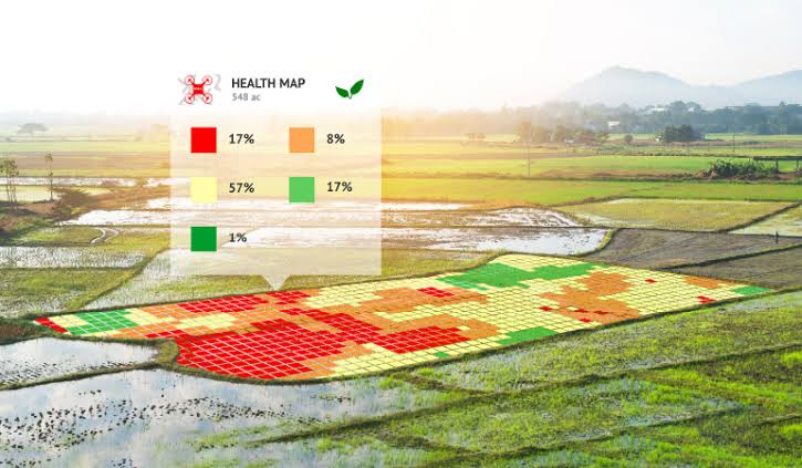
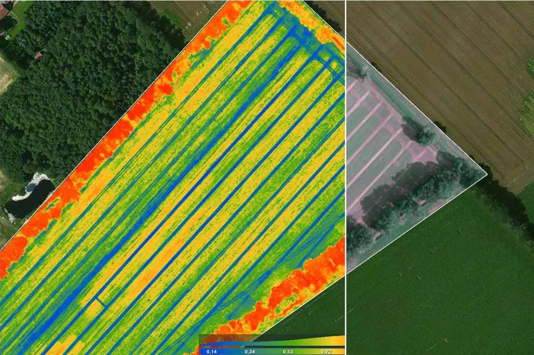
Precision agriculture through drone technologyGeoDrone Solution leverages advanced aerial imaging to optimize agricultural productivity. Our drones capture multispectral and RGB imagery to analyze crop health, irrigation patterns, and soil conditions. This enables farmers to make data-driven decisions and maximize yield.
- Monitor crop health using NDVI analysis
- Identify irrigation issues and nutrient deficiencies
- Plan efficient resource allocation and harvest timing