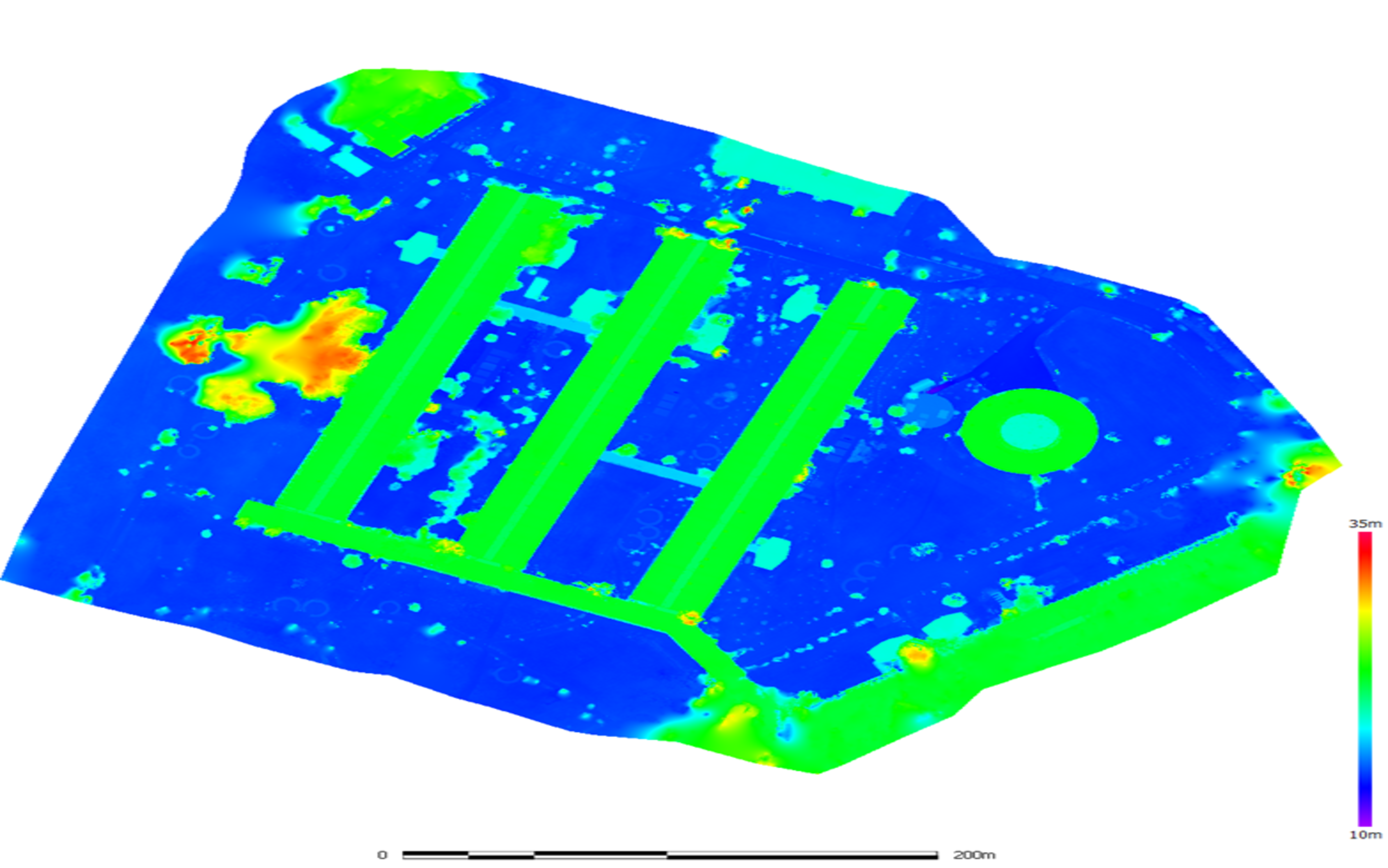
2D & 3D Mapping
Orthophotos, DSM, and DTM generation for analysis & visualizationGeodrone Solution provides 2D and 3D mapping through advanced photogrammetry techniques. Using drone imagery, we generate orthomosaics, Digital Surface Models (DSM), and Digital Terrain Models (DTM) for planning, design, and analysis.
- High-resolution orthomosaics.
- Accurate DSM/DTM creation.
- Supports planning and GIS workflows
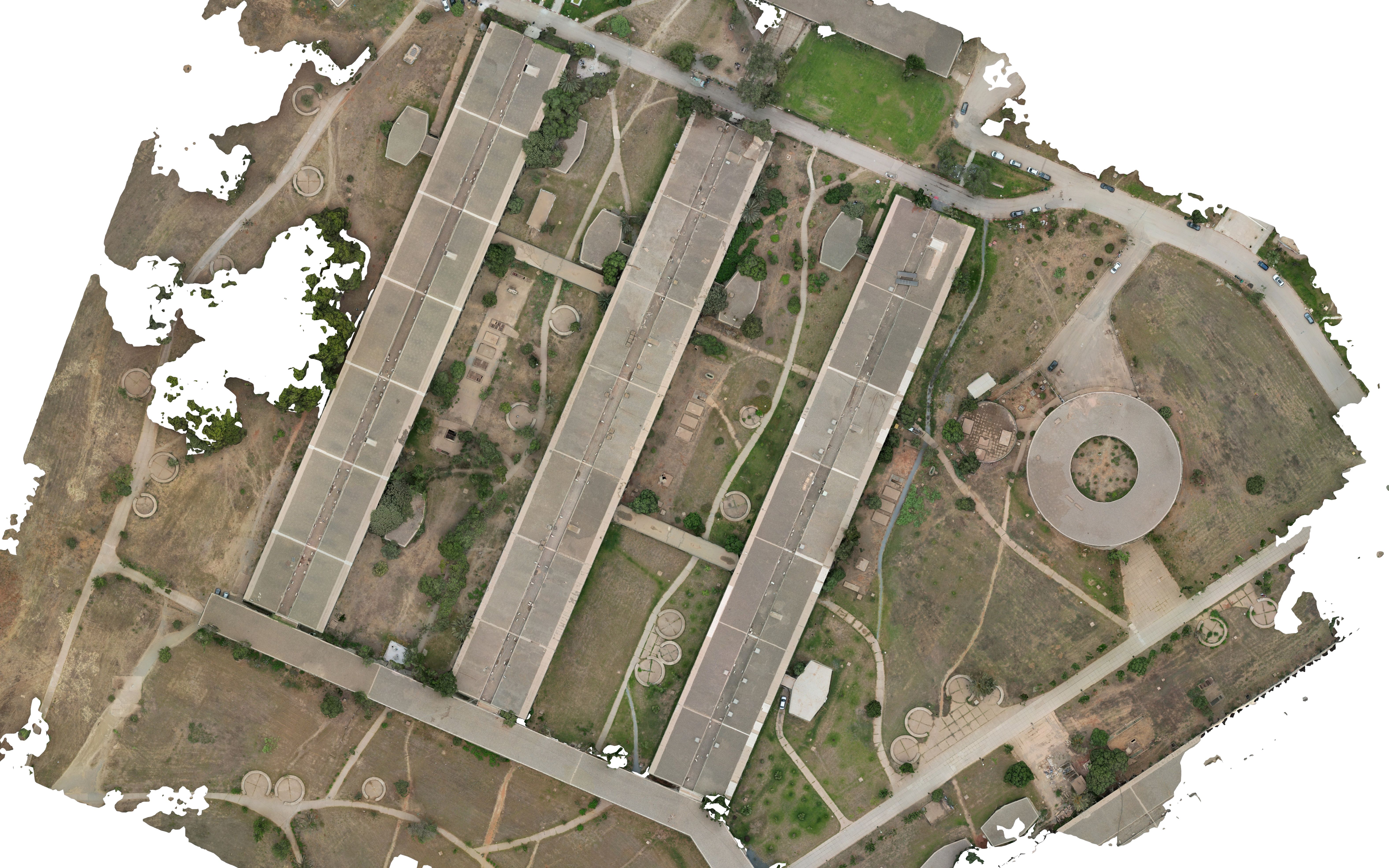
Orthophoto Generation